Seismologists Map 250-km Linear Earthquake Cluster Beneath Alaska


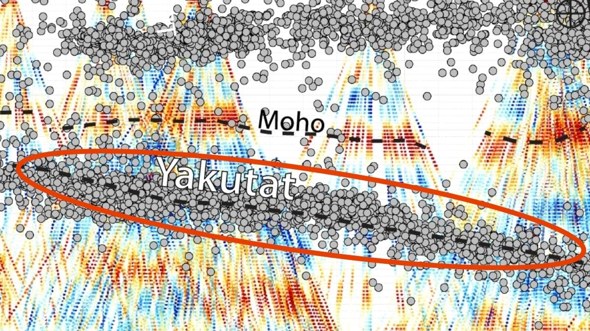
A team of seismologists led by Meghan Miller of the Australian National University mapped a 250-kilometre linear cluster of small earthquakes that traces the edge of the subducted Yakutat slab beneath central Alaska, ScienceAlert reported. The researchers applied machine-learning techniques to a dense catalog of seismic recordings to isolate the previously hidden sequence of events. The resulting map shows a remarkably sharp, roughly 250-kilometre-long line of micro-earthquakes that delineates the slab’s leading edge.
According to the authors, the pattern provides new insight into the distribution of tectonic stress in the region. The team noted that the cluster’s geometry may help explain the mechanics of the Denali earthquake. Their findings were published in The Seismic Record.